Cass Saddle - Avoca River - Klondike Corner
I did this trip in the middle of winter, with Rob Blake - a mate from
Lincoln Uni. Currently under work!
Day 1
Cass River Bridge - Cass Saddle - 10.5km
Cass Saddle - Hamilton Hut - 4.5km
We started at the junction of Cass River (480m) and the Arthurs Pass Highway. The first
day of our walk follows the Cass Lagoon Saddle walk. We parked
our car in the parking lot (500m south of the Cass River bridge)and followed the 4WD track to a
forestry sign
and hutbook. Turned to the right and followed the red flags up the stream.
This stream needs to be crossed many times, so may be impassible when the
levels are high. The track leaves the stream and climbs out on the true
right about 5km (1.5 hours) into the walk. The track then goes through bush until
a stream is crossed and the Cass Saddle Hut (1260m) is found up on the rise. The hut sleeps
2, but could fit about 6 in a squeeze. This was a good place for us to put
on our cold weather gear, as it was snowing and blowing out in the open.
The bush opens up to tussock about 100 yards above the hut. There is a
gentle climb to the rather exposed Cass Saddle (1328m) where the track descends down
the left of the valley. The descent is rather steep (make sure you cut
your toenails - I lost both big toenails!!). Reach the valley floor and
follow a large clearing to Hamilton Hut (840m) up on a ledge in the distance.
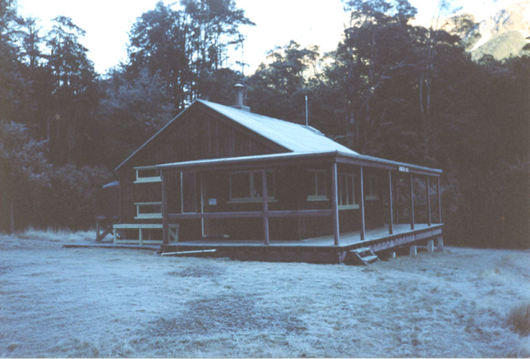
Hamilton Hut - early morning.
We met here a group of foreigners who had walked that day down the river
where one of them had tried to cross the river using a wire rope. Halfway
accross he fell onto his head, but seemed to be alright. Lucky bugger!
Day 2
Hamilton Hut - The Pinnacles - 9.5km
The Pinnacles - Triangle Hut - 8km
Triangle Hut - Basin Hut - 3.5km
Woke up to the hut looking like it does above, cold. The hut can fit
20 or so people. It has a great fireplace and view.
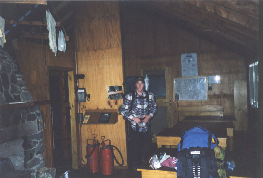
Rob in the hut with a huge fireplace to the left of him. This was a very
cosy hut.
Left the hut and followed the track down past the swing bridge accross Hamilton Creek.We then
followed the track to the junction of
Hamilton Creek
and the Harper River. About 5 mins below the junction there is a 4WD track that
can be easily followed down the valley. The walk is just a matter of
finding the simplest route between two flat points, and watching out for
the bog. Usually, the 4WD track is the simplest, but it does take some
unnecesary turns at times. Boundary Stream Hut is marked on the map, but got
washed away a couple years previous. We saw bits of roofing iron and studs downstream.
Follow the river until a sign is seen up on a
river bench pointing to The Pinnacles (760m). The track up there will provide a
view from the top, but there is just as good a view from the base. Keep
following the 4WD track to the west and up the Avoca River valley. There
is a heap of gravel bashing to be done along here and it soon gets boring.
There is a very good road on the true left that makes for simpler
walking.
The Triangle Hut is derelict, but could be used if shelter was really needed, as
half the roof is caved in. The road crosses the river past the hut and
moves onto a clay bog road that winds between spurs of beach trees. Basin Hut
appears around the corner and its older companion accross the stream. The hut on
the true right is an old forest service hut that used to be locked, but is now open for all. It
has bunks for 6 people and concrete floor with bench and outdoor water supply from the
roof. The hut is often used as an endpoint for 4WD expeditions.
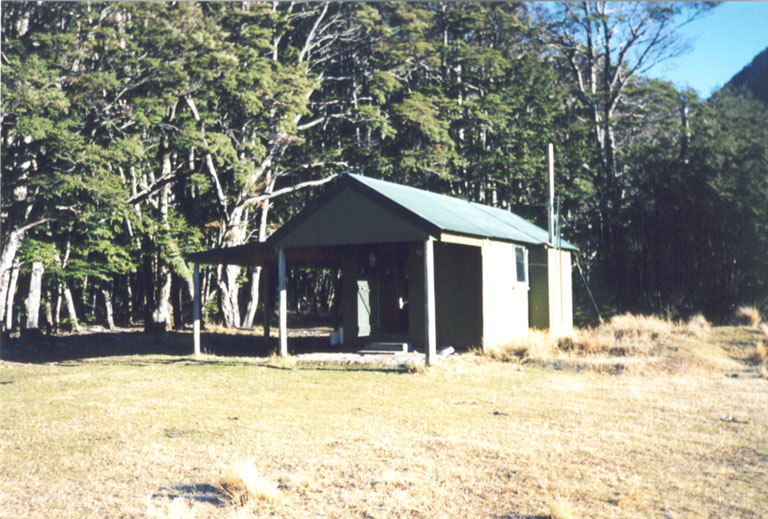
Basin Hut. A well made hut, with a smoke problem. The 1994 Arthurs Pass
earthquake dislodged the fireplace, so now it smokes profusly into the
room.
There are a couple of possums around the hut, and possibly the ghost of
the deer skull that peered up at me from inside the long drop.
Day 3
Hamilton Hut - Galileo Creek - 4.0km
Galileo Creek - Jordan Saddle - 2.5km
Jordan Saddle - Campsite - 1.5km
My toes had been hurting from the previous day, so we decided to cut our
walk a bit shorter and take a pass closer to us. Thee was also a storm
predicted to arrive in the area in the next couple of days, so the sooner
we got over the tops the better. So, instead of Sphinx Saddle, we chose
Jordan Pass.
Leaving the hut, the day begins with crossing the Basin Stream. The older
hut has a mud floor and isn't so clean. Walk out to the Avoca again and
cross it. There is an unmarked 4WD trail along the true left up to about
Amphitheatre Creek. We turned right at Galileo Creek and went uphill. There is the occasional
cairn on the way up. The most important thing to remember is to take
the true right fork when you get near the top. The fork is just above
another fork, with the main branch taking off to the true left. The route
leads off to the left and reaches the tree line after a short climb.
From here on it became rather icy and we didn't have crampons or ice ax.
Luckily, Rob had a tomahawk and this allowed us to get along. The best
advice is to stay in the creek bed all the way up, as the head of this
creek is about 50 metres above the real pass. Climb out of the creek on
the true left and walk down the ridge to Jordan Saddle (1469m). The view from here is
amazig, looking up the Anticrow River and along the Waimakariri River.
The track down the stream is not well marked. There is the occasional
troden part, but mainly it is make your own way, with some quite steep
sections that would not be good on a wet day!
As it was about the shortest day of the year, sunlight was leaving us. We
hunted around for a camp site and found one up on a ledge. It was not
easily seen from the creek bed and we fluked apon it. It was wide enough
to fit the tent, and that was it.
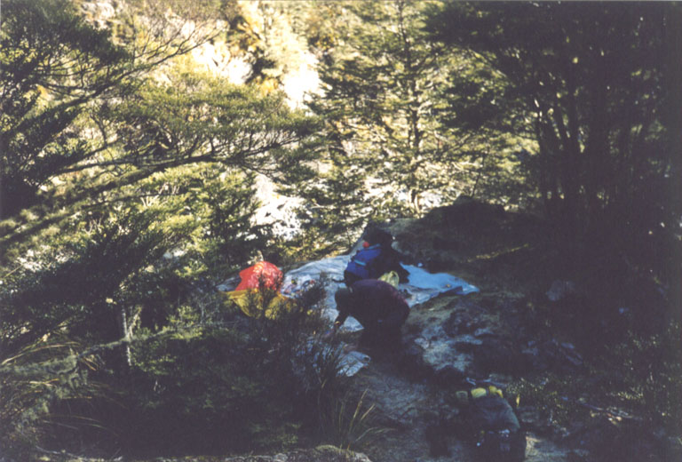
Rob setting up camp. There is a drop behind the tent and to the right,
with a slope leading up towards me. The site was just the right size.
We couldn't get a fire going because all the wood was frozen. However,
sleeping bags and lots of hot drinks solved the problem. We filled in all
the gaps in the fly and went to sleep. A good night actually, not too
lumpy.
Day 4
Campsite - Waimakariri River - 6.5km
Waimak River - Klondike Corner / Road - 1.5km
We woke up to find that it was bloody cold (we were about 1000m high) and that our boots had frozen
solid over night. Really solid. So warm water solved that one. It was a
sunny morning, so packing up didn't take long.
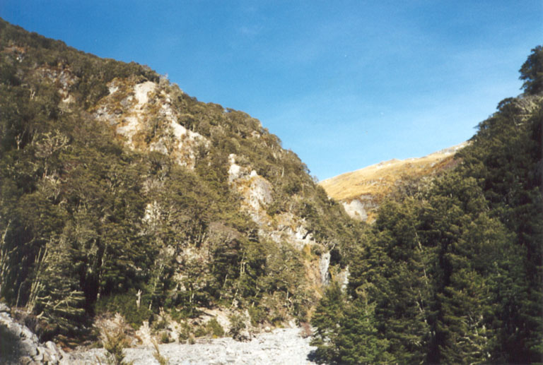
View from the creekbed up the valley.
Basically, a creek
crossing
day until we hit the Waimak. The Waimak was fairly low so was simple to
cross. If there had been rain, the creek down from the pass would have
been very dicey to get accross in some spots.
We walked to Klondike Corner (646m) and Rob went hitchhiking to get the car. I
made a hot drink and waited for him. A 2 hour drive back to Christchurch
finished the 4 days.